
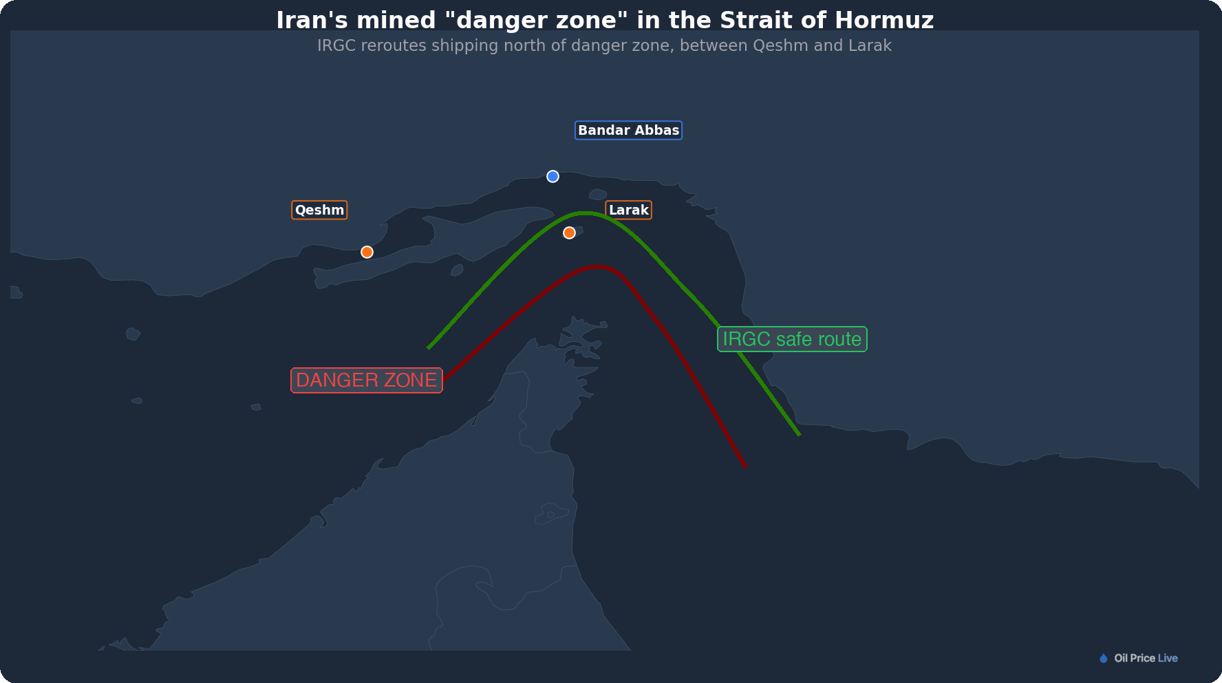
Iran's Revolutionary Guard has effectively admitted to mining the Strait of Hormuz. On Thursday, two semi-official Iranian news agencies published a chart showing a large "danger zone" drawn over the standard shipping route through the strait, with an alternative path plotted closer to Iran's coast near Larak Island.
The chart was released by ISNA and Tasnim, which is closely tied to the IRGC. It covers the period from February 28, when the war began, through April 9. The Maritime Executive published a detailed breakdown of the redrawn traffic scheme. A separate IRGC statement warned that vessels attempting the old route without authorization would be "targeted and destroyed."
Oil pulled back from a morning high above $102 to settle near $98 as markets weighed how long physical mines will keep the strait shut, even if diplomats reach a deal.
What the chart shows
The normal route through Hormuz follows what's called the Traffic Separation Scheme, a pair of two-mile-wide shipping lanes that carry inbound and outbound traffic along the Omani side of the strait. That route is now marked as a danger zone (red).
The IRGC's replacement channels vessels through Iranian-controlled waters (green). Inbound traffic is routed between the islands of Qeshm and Larak. Outbound ships pass south of Larak. Both lanes sit within easy reach of IRGC patrol boats, making every transit subject to boarding, identity checks, and escort requirements.
It amounts to a permanent checkpoint. Even ships with permission to cross now travel under the Guard's direct watch.
The mines themselves
CBS News reported in late March that US officials had identified about a dozen Iranian mines in the strait. Open-source intelligence analysts identified them as two types: the Maham-3, a 300-kilogram moored mine equipped with magnetic and acoustic sensors that detects passing ships and detonates without contact, and the Maham-7, a 220-kilogram bottom mine whose hull shape is built to deflect sonar signals, making it extremely difficult for conventional mine-clearing gear to find.
Iran holds more than 5,000 naval mines in its arsenal, according to defense analysts. Only a fraction have been deployed so far, but even a dozen are enough to shut down commercial traffic through the world's most important oil chokepoint.
No minesweepers in the Gulf
The US Navy's only two ships equipped for mine countermeasures in the region, the USS Tulsa and USS Santa Barbara, were relocated to Malaysia and Singapore in mid-March. The four Avenger-class minesweepers they replaced were sent for scrapping in January 2026. NATO allies have so far declined US requests for mine-clearing support.
Clearing Hormuz would take weeks under ideal conditions. With mines built to evade detection and no dedicated sweepers on station, the timeline stretches further. A ceasefire deal in Saturday's Islamabad talks can stop the bombing, but it can't clear the water overnight.
The mine chart is the clearest signal yet that Iran intends to keep control of Hormuz regardless of what happens at the negotiating table. Diplomats can agree to terms. Mines don't care.